New Insights in Vegetation Fuel Mapping for Enhanced Wildfire Management
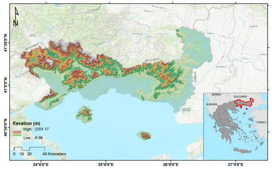
In February 2023, RiskAC’s Fire Hazard team published a pioneering research article in the Remote Sensing MDPI journal. The study, titled Vegetation Fuel Mapping at Regional Scale Using Sentinel-1, Sentinel-2, and DEM Derivatives—The Case of the Region of East Macedonia and Thrace, Greece, harnesses advanced remote sensing techniques to improve the accuracy of fuel type mapping across diverse landscapes. By integrating optical and radar data with topographic information, the research offers a robust approach to assess wildfire risks and bolster fire management strategies, ultimately contributing to a more resilient and secure regional ecosystem. This breakthrough publication underscores our commitment to leveraging cutting-edge technology for enhanced disaster preparedness and sustainable land management.
Remote Sensing Journal Publication: https://tinyurl.com/2s4f9np7