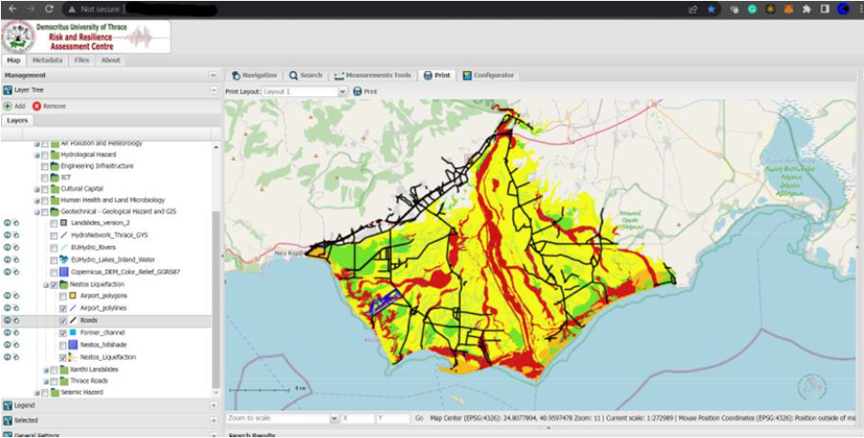
1. WebGIS System
Our web-based Geographic Information System stores, processes, and provides research results from RiskAC teams in the form of vector maps. This system allows for spatial visualization of hazards, vulnerabilities, and risk assessments across the Region of Eastern Macedonia and Thrace.
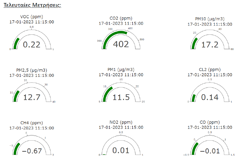
2. Data Dashboard
We've created an interactive dashboard for presenting time series measurements from our sensors, accessible on computers and mobile devices. This tool provides real-time monitoring of environmental parameters critical for early warning and situation awareness.
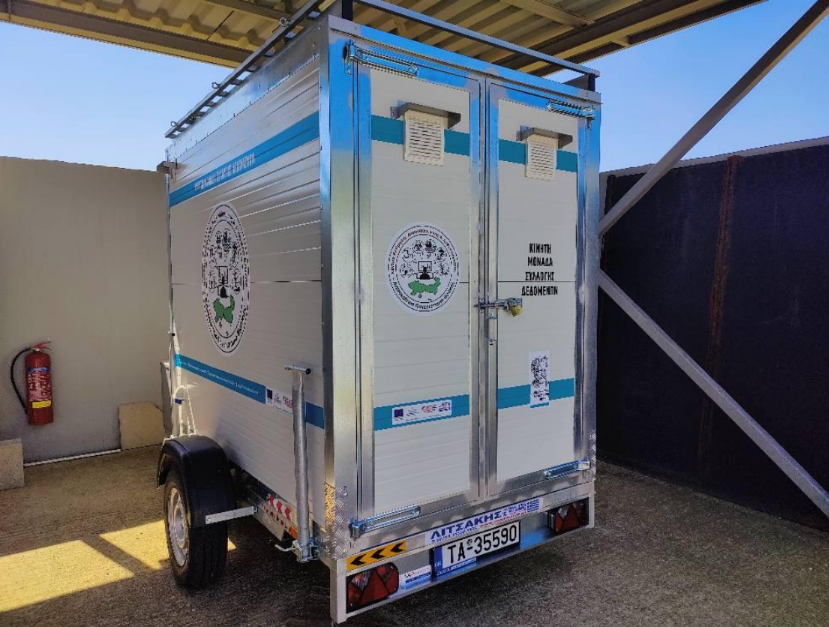
3. Mobile Monitoring Unit
Our specially equipped trailer functions as a mobile multi-sensor platform that can be deployed to disaster-affected areas, providing real-time data on environmental conditions, air quality, and other critical parameters.
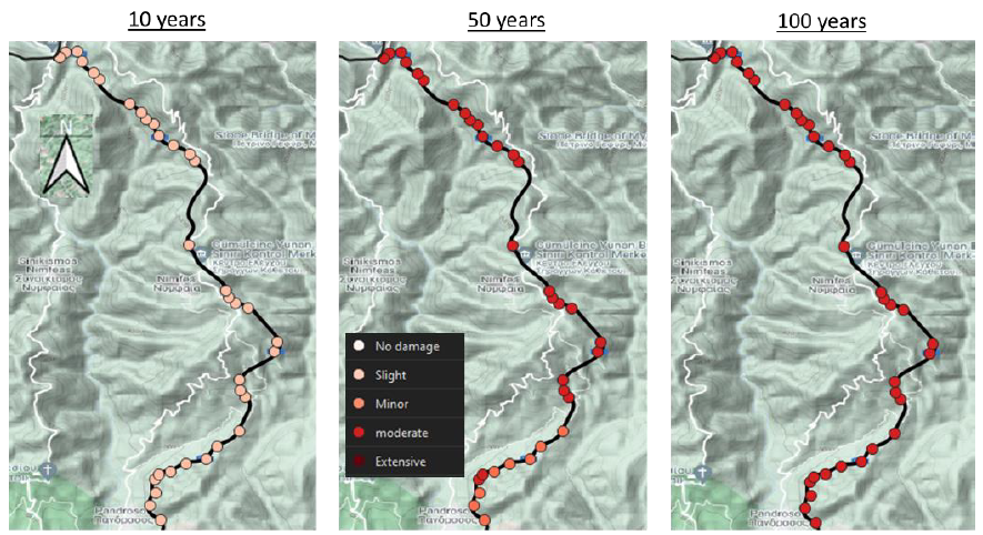
4. Simulation Models
We've developed specialized simulation models for:
- Forest fire behavior and spread
- Flood scenarios for various return periods
- Seismic risk assessment
- Air pollutant dispersion
- Landslide and liquefaction susceptibility